
Geography: Grade 10 8 Sections26 Lessons365 Days
1.3. Major Landforms of Africa
Major Landforms of Africa
Geography Grade 10
Lesson Competencies
At the end of this lesson, you will be able to:
Identify the eight major landform regions of Africa.
Describe the key characteristics of each major landform.
Explain how tectonic activity shaped features like the Rift Valley.
Understand the influence of these landforms on climate and human life.
Key Terms
Tectonic Plates
Massive, rigid pieces of Earth’s lithosphere that move slowly over the asthenosphere, causing continental drift and geological events.
Rift Valley (Graben)
A lowland region formed by the sinking of a block of land between two faults or sets of faults as tectonic plates pull apart.
Desertification
The process by which fertile land becomes desert, typically as a result of drought, deforestation, or inappropriate agriculture.
Escarpment
A long, steep slope, especially one at the edge of a plateau or separating areas of land at different heights.
Video Lesson
Core Lesson: Africa’s Diverse Landforms
Dear learners, have you ever wondered why Africa is such a diverse continent? It has vast deserts, dense rainforests, towering mountains, and deep valleys. Much of this variety is because of powerful forces deep within the Earth.
Africa’s landforms are mainly shaped by tectonic plate movement and volcanic activity. These features don’t just make the continent look beautiful; they strongly influence its climate, ecosystems, and the way people live. Let’s explore the eight major physical regions of Africa!
Map of Africa’s Major Landforms
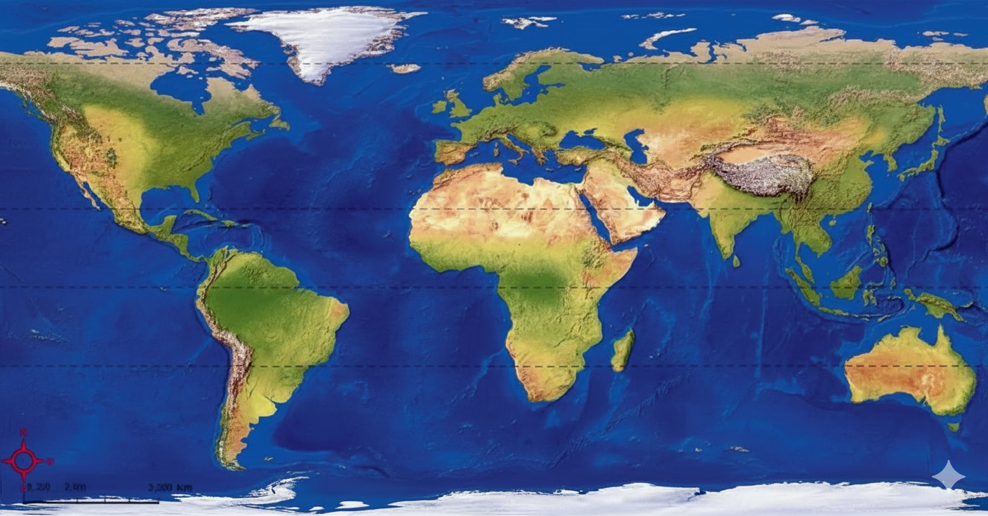
1. Atlas Mountains (North Africa)
- Stretches over 2,000 km across Morocco, Algeria, and Tunisia.
- Composed of several ranges, including the High Atlas, Middle Atlas, and Sahara Atlas.
- Acts as a crucial natural barrier between the Mediterranean coast and the vast Sahara Desert to the south.
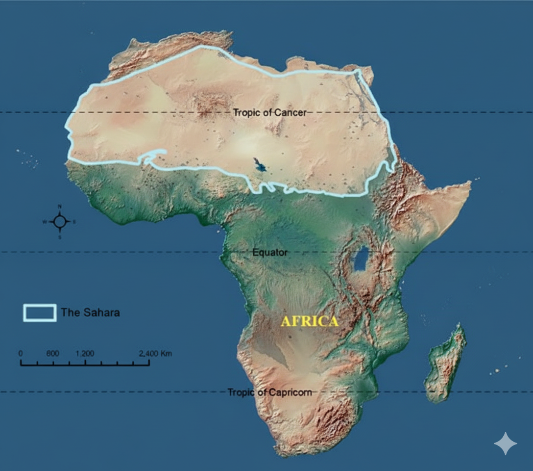
2. Sahara Desert
- The world’s largest hot desert, covering about 9.2 million km² across 10 countries.
- Features a varied landscape of sand dunes (ergs), flat gravel plains (regs), and rocky plateaus.
- Despite its extreme climate, it has historically been a center for trans-Saharan trade routes.
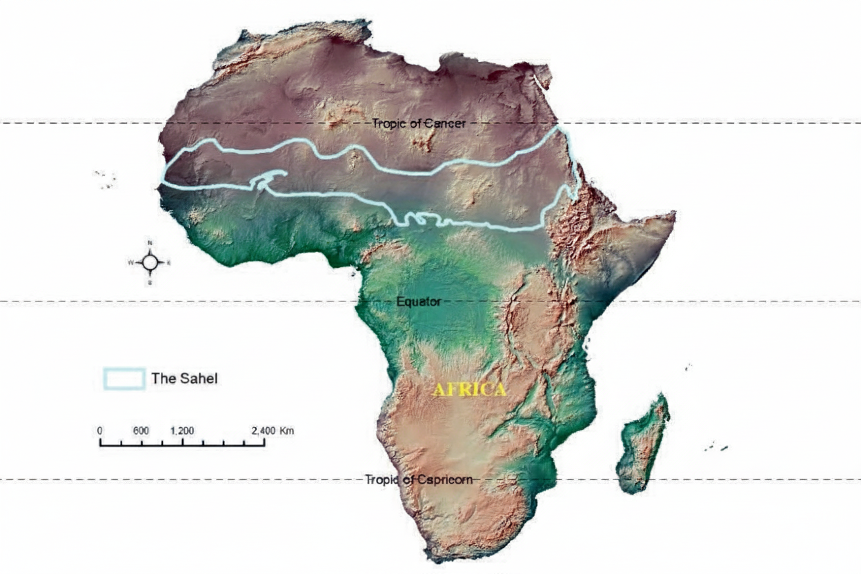
3. Sahel Region
- A semi-arid transition zone just south of the Sahara, stretching 5,000 km across the continent.
- The name “Sahel” means “shore” in Arabic, as it is the “shore of the desert.”
- This region of grasslands supports livestock and farming but is highly vulnerable to desertification.
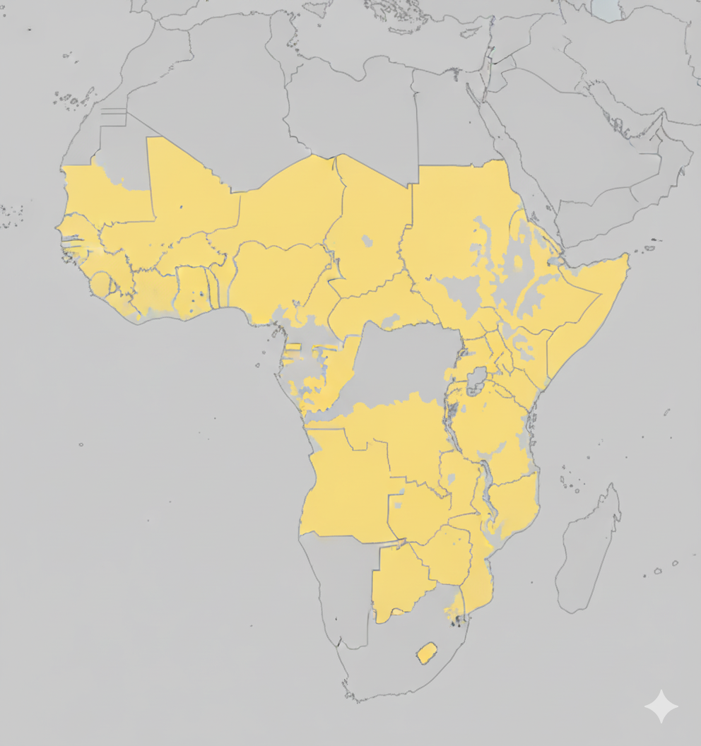
4. Savanna
- Tropical grasslands with scattered, drought-resistant trees like acacias and baobabs.
- Adapted to a hot climate with distinct rainy and dry seasons. Frequent fires are a natural part of its ecosystem.
- Supports Africa’s famous wildlife, as well as cattle grazing and farming.
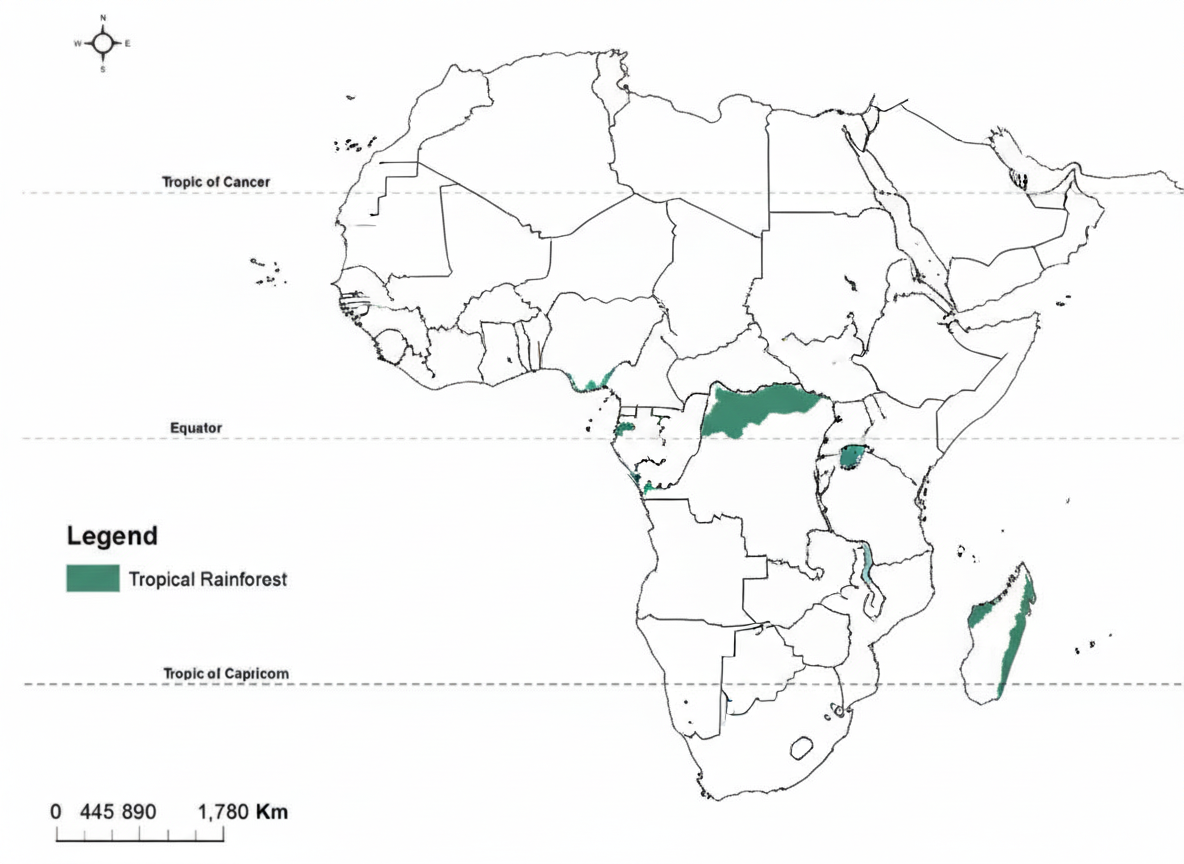
5. Tropical Rainforest (Congo Basin)
- Located around the Equator, mainly in the Congo Basin.
- Characterized by dense evergreen vegetation with a tall canopy that blocks most sunlight from reaching the floor.
- Receives over 2000 mm of rain annually, creating Africa’s most biodiverse ecosystem.
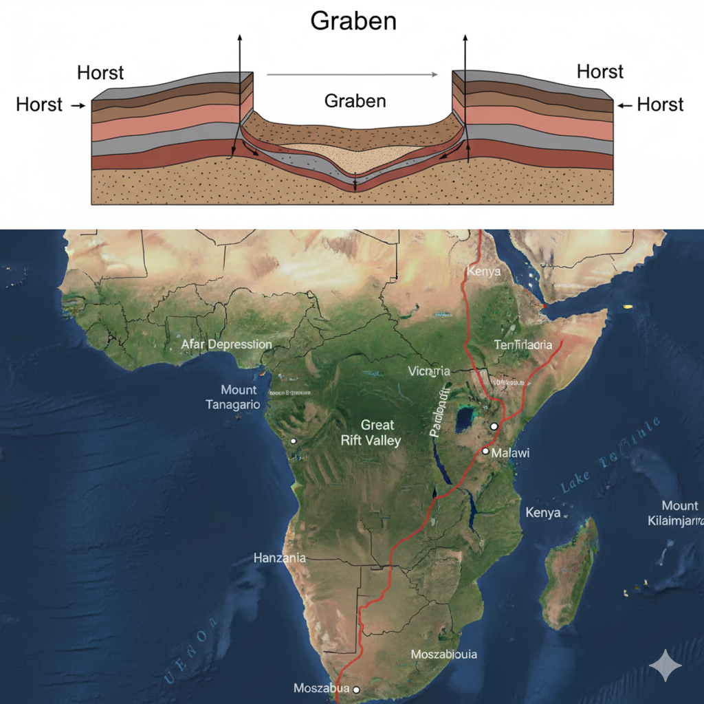
6. Rift Valley & African Great Lakes
- A massive geological trench formed by tectonic plates pulling apart (graben formation).
- Stretches 5,600 km from the Red Sea down to Mozambique.
- Home to many deep lakes like Tanganyika and Malawi. Lake Victoria, Africa’s largest lake, lies between the rift’s two branches.
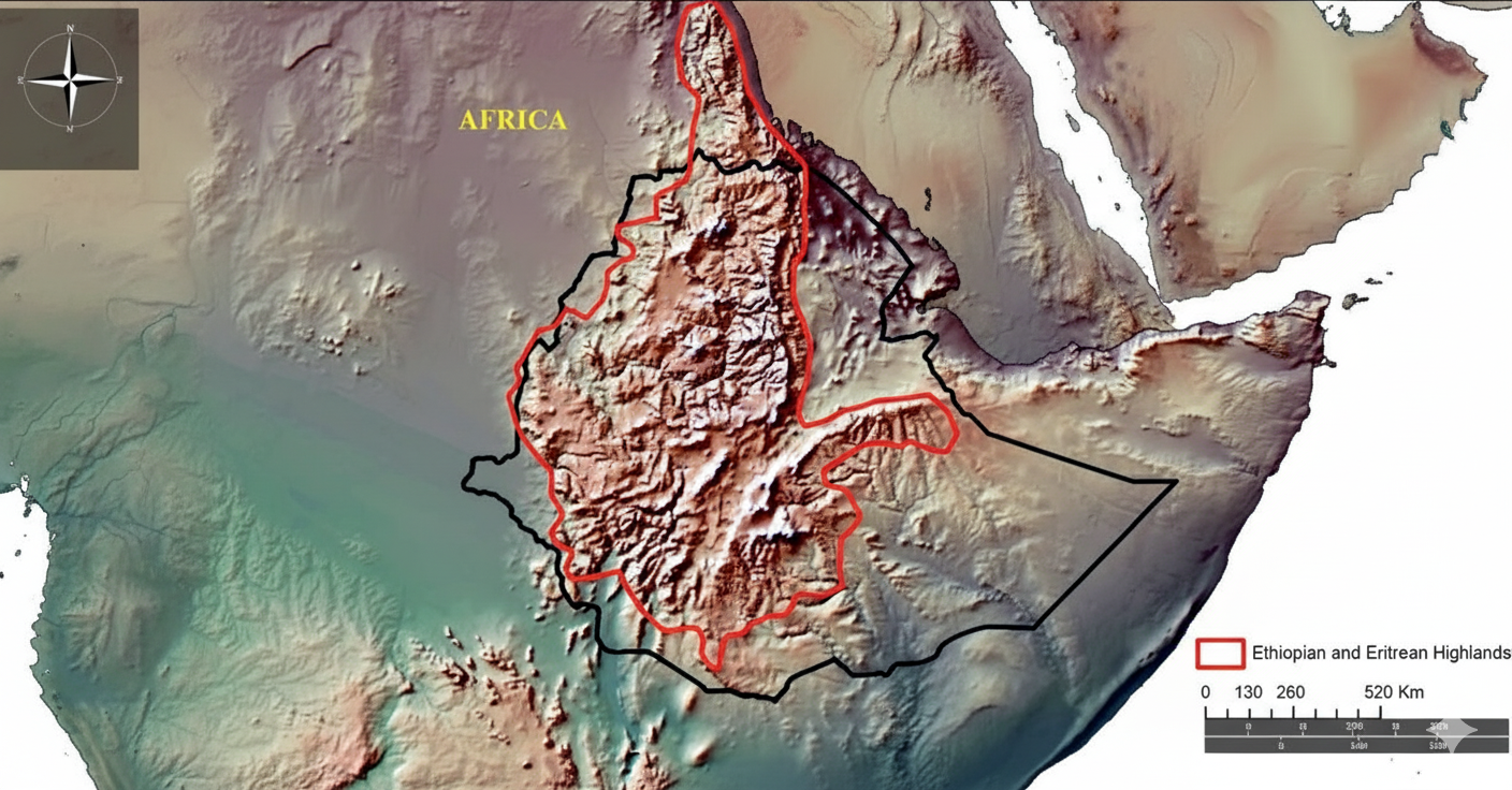
7. Ethiopian Highlands
- Often called the “Roof of Africa,” with elevations over 2,000 meters.
- These rugged mountains are split by the Rift Valley and are the source of the Blue Nile (Abbay) River.
- The fertile volcanic soils and cooler climate support a dense population.
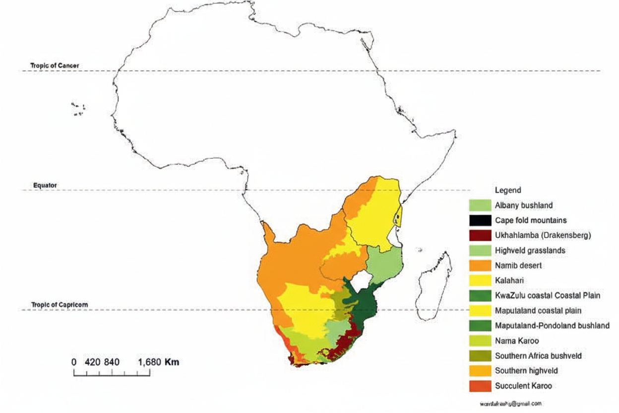
8. Southern Africa: Mountains & Desert Systems
- Includes the mighty Drakensberg Escarpment, a major mountain range.
- Contains the semi-arid Kalahari Desert and the coastal Namib Desert, one of the world’s oldest.
- The fertile Highveld Plateau is a major farming and urban region.
Activity 1: Check Your Knowledge
Activity 2: Match the Landform
Drag each landform name to its correct description.
Landforms
Descriptions
A semi-arid transition zone south of the Sahara, vulnerable to desertification.
A huge trench formed by tectonic plates pulling apart, containing many large lakes.
Known as the “Roof of Africa,” it is the source of the Blue Nile River.
Tropical grasslands with scattered trees, home to Africa’s iconic wildlife.
A mountain range in North Africa that separates the Mediterranean from the Sahara.
Activity 3: Mixed Challenge
Lesson Summary
Africa is a continent of incredible geographic diversity, shaped primarily by tectonic forces and volcanic activity. Its landscape is dominated by vast plateaus and basins.
Key regions include the Atlas Mountains in the north, the immense Sahara Desert and its transitional Sahel zone, the wildlife-rich Savannas, and the biodiverse Congo Rainforest.
The monumental Great Rift Valley showcases the power of diverging tectonic plates, creating deep lakes and highlands like the Ethiopian Highlands. Southern Africa features its own distinct systems, including the Kalahari Desert and the Drakensberg mountains.
Final Assessment
Competency Checklist
Review what you’ve learned and check off the competencies you are now confident with.